BC LAND ENTERPRISES / LAND PLANNING & RESOURCES
Good Work Starts
Before the First Pass.
You have a vision for your land. We help make sense of the conditions, the options, and the steps to get there—so planning your project feels like progress, not another job on your list.
Let’s Plan Your Project →See what goes into the plan ↓LESS ON YOUR PLATE. MORE CLARITY.
Your Vision.
A Thoughtful Plan.
From a small clearing project to a larger property improvement, the right approach starts with how you want to use the land.
Our planning approach brings your priorities together with the conditions that matter to the work. We explain the choices in plain language and work with your schedule.
You do not need a finished plan or all the answers to reach out. Send what you have. A site visit can usually be arranged without you being there when access is agreed in advance.
- 1
Start with the life you want on the land.
Tell us what you want to change, what you want to keep, and what success would look like. We talk through location, approximate size, budget, timing, and how you prefer to connect.
What you see: A conversation centered on your priorities.
- 2
Look beyond the surface.
Photos, available maps, and a site review help identify relevant questions about access, drainage, ground conditions, vegetation, and the proposed work area. We flag items that need closer investigation or a specialist.
What you see: Clear questions, practical options, and the reasons behind them.
- 3
Define the work and the finish.
We discuss the clearing limits, trees to retain, grading or gravel needs, material and debris handling, and the finish you expect. Scope, assumptions, and any exclusions should be clear before work begins.
What you see: An estimate you can discuss and a shared picture of the result.
- 4
Coordinate the details.
Access, equipment, ground conditions, weather, applicable approvals, and utility locating all affect the sequence. We work through the relevant requirements and keep you involved when conditions change.
What you see: A coordinated next step and communication that respects your time.
- 5
Review the result together.
We review the completed scope with you, in person or through agreed updates and photos. Any follow-up needs—such as vegetation regrowth, gravel upkeep, or the next construction phase—can be discussed.
What you see: Work measured against the plan you agreed to.
BEHIND THE SCENES / QUESTIONS THAT SHAPE THE WORK
Know the Land.
Choose the Right Approach.
These are the kinds of conditions that can affect a land project. Open a topic to see why it matters and explore the public resources behind the research. We help connect the information to your project; you do not have to sort through it alone.
WATER Flood Zones & Drainage
FEMA’s Flood Map Service Center is the official source for National Flood Insurance Program flood mapping. A map review helps identify mapped flood hazards; drainage planning also needs to consider what happens on the property itself.
Planning questions
Where does water collect or flow? Are there ditches, low spots, nearby structures, or neighboring properties to consider? Does the proposed work need local floodplain review?
What it means for you
Discuss the water-related constraints before deciding where and how to work. A mapped zone is not a guarantee that land will never flood.
OSU Extension: Drainage Planning ↗
GROUND Soil, Rock & Working Conditions
USDA Web Soil Survey offers mapped soil information for land-use planning. It can help guide questions about soil conditions, drainage, and limitations, but it does not replace project-specific investigation.
Planning questions
Is the ground wet, soft, steep, or visibly rocky? Is there existing fill? What equipment access is available? Could buried rock or unsuitable material change the approach?
What it means for you
Surface observations and soil maps help start the conversation. Hidden conditions, rock quantities, and bearing capacity may require testing or specialist review before a final design or construction decision.
CLEARING Mulching or Removal?
OSU Extension describes grinding or mulching as one option for managing woody debris. The best choice depends on the vegetation, access, intended use, and the finish you need.
Planning questions
Are you opening a trail, reclaiming an area, or preparing for future construction? Should material be mulched in place, gathered, or removed? Are stump and root removal part of the scope?
What it means for you
Mulching vegetation is different from removing stumps and roots or preparing a construction-ready surface. We talk through those differences so the quoted finish matches your plans.
TREES What Stays Matters, Too.
OSU Extension explains that soil compaction, excavation, and changes in grade can damage retained trees. Planning the work area includes considering the trees you want to keep.
Planning questions
Which trees provide privacy, shade, or character? Where can equipment travel and materials be staged? Are there trees near buildings, overhead lines, or other sensitive areas?
What it means for you
Identify the keep areas before clearing begins. Trees with health or stability concerns, or work near utilities, may need assessment by the appropriate specialist.
ACCESS Utilities, Boundaries & Approvals
OKIE811 is Oklahoma’s utility notification resource for ground-disturbing work. Utility locating, property limits, and any applicable permissions should be addressed before the relevant work starts.
Planning questions
Where are the access points, fences, easements, septic areas, wells, and known lines? Are the work limits clear? Does the local authority require a permit or floodplain approval?
What it means for you
We discuss which checks apply and who is handling them. Utility markings do not establish property boundaries or replace a survey. Private facilities may need separate locating.
FINISH Timing, Materials & Next Steps
A useful plan connects the work happening now with what you want to do next. The right finish for a wooded trail may be very different from the finish for a gravel entrance or a future building area.
Planning questions
What comes after this phase? What material is needed? How will debris be handled? What weather or ground conditions could affect the schedule, and what maintenance should you expect?
What it means for you
Agree on the intended use, finish, and project limits before work starts. If the scope needs to change, discuss the options, cost, and timing together.
These resources support early planning. The checks needed depend on the property and scope. Maps and general guidance do not replace a boundary survey, utility locating, permits, engineering, geotechnical testing, or an arborist’s assessment where those are needed. Sources: FEMA, USDA NRCS, Oklahoma State University Extension, and OKIE811. Links reviewed October 2026.
A SHARED PICTURE OF SUCCESS
Know What You’re
Working Toward.
The result should reflect the way you want to use your property. These examples show what to discuss when defining the finish; your estimate sets the actual scope.
See real BC Land projects →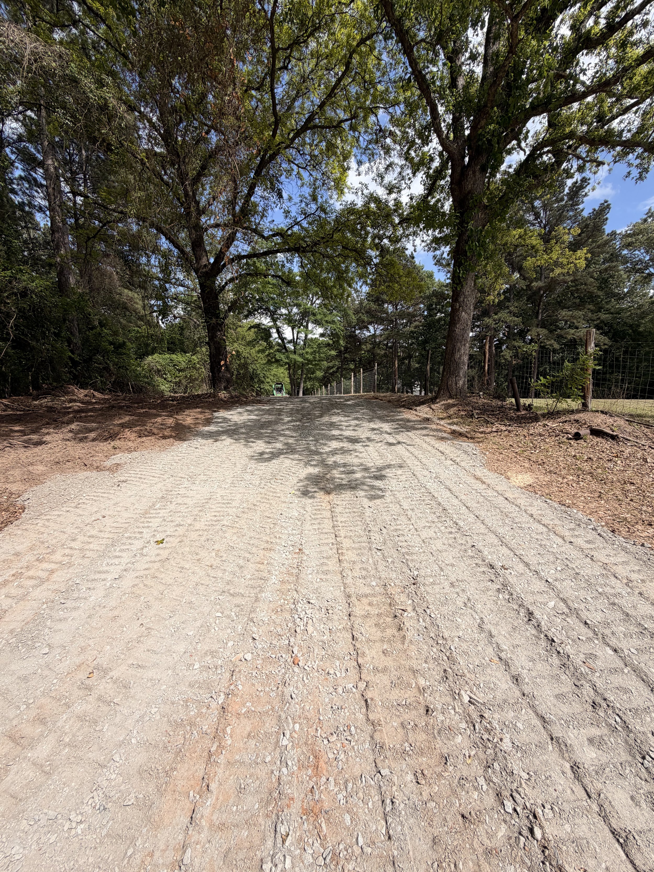
| Your Goal | The Plan Should Clarify |
|---|---|
| More usable land | Clearing boundaries, trees to retain, debris handling, and whether stumps or roots are included. |
| A better gravel approach | Access, intended traffic, surface preparation, material, water flow, and the agreed finish. |
| Ground ready for its next phase | Grading limits, intended elevations or finish, remaining work, and any specialist design or testing needed. |
| A project that fits your life | Budget priorities, possible phases, access arrangements, updates, and how completion will be reviewed. |
AN EASY FIRST STEP
Send What You Have.
We’ll Help with the Rest.
No research packet required. A few photos and a short description can get the conversation started. Photos, acreage, and budget are helpful if available.
- Property address or map pin
- What you want done
- Photos or a short video
- Approximate project area
- Budget range, if you have one
- Timing and access details
- Trees or features to keep
- Your preferred way to connect
Choose a call, text, online request, Zoom, Microsoft Teams, or an in-person conversation. You do not have to be at the property for an estimate visit when access is arranged with us.
YOUR PROPERTY. YOUR PRIORITIES.
Let’s Take the Next Step Together.
No project is too big or small to start a conversation. Thank you for considering BC Land Enterprises. We want to work with you, your vision, and your schedule—from the first quote through the finished project.
Request Your Free Estimate →Prefer to text? (405) 317-2901 ↗